I don’t carry a map when I’m hiking. Most of us use a guide book. Mine is written by a well known hiker named “AWOL”. Here’s a page of it:
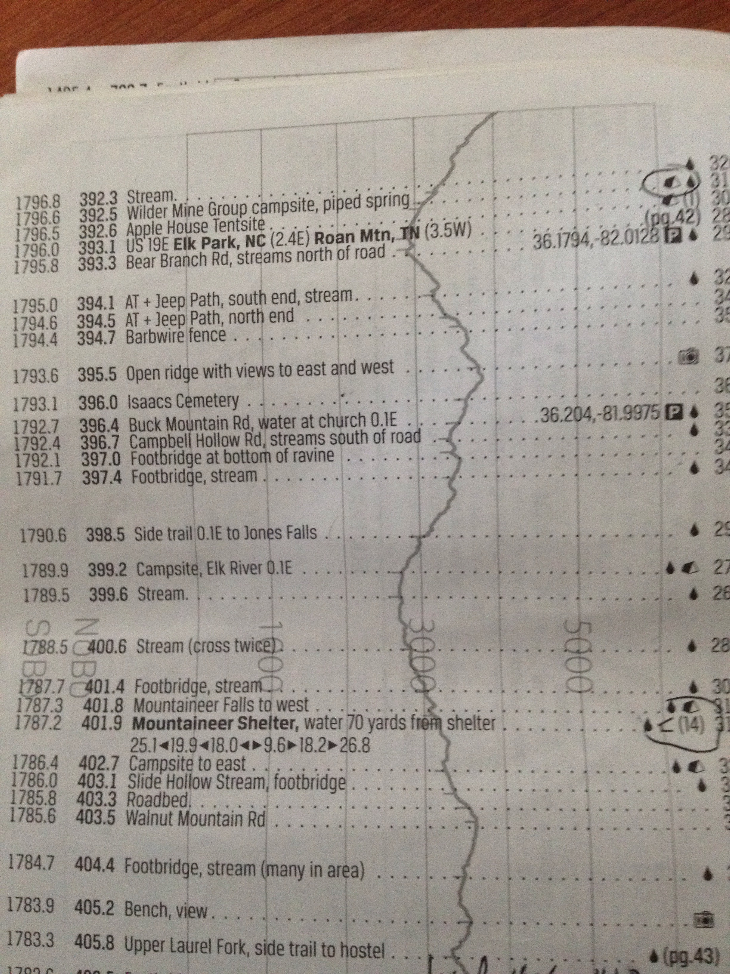
A northbound hiker like myself would use the second column to keep track of how many miles have been completed from the beginning (Springer Mtn in Georgia). To the right of that mileage column are brief written descriptions of landmarks and points of interest. The symbols to the right of that indicate options for shelter or tent campsites and drinking water availability.
The elevation of the trail is recorded by the grey line that runs up and down on the page with a scale that runs from 0 to 6000 feet.
When I get back on the trail Tuesday, I’ll start at mile 393.1. Looks like I’ll be climbing for a while (2.5 miles), then descending for 4 miles. Lots of water options along the way (marked by the black droplet symbol).
This guidebook is instrumental in planning a day’s hike.


Fascinating! I would need MANY more shelter options! Thanks for taking the time to explain this incredible journey. We discuss your blog entries at the dinner table.
LikeLike